
Trace a Farmington Street Address
Street research in Farmington begins with a particular address, including its directional and unit details when known. San Juan County property records can connect the situs, or property location, with a county account and parcel number. Those identifiers make later checks more precise. They do not establish a present occupant, a full title chain, or a personal relationship to the property. Keep the source label with every result, because an assessment owner, an owner mailing address, and a party to a recorded instrument can describe different things.
Use this sequence for a documented address question. It follows the public pathways Farmington and San Juan County actually maintain, rather than treating a street name as a single all-purpose search.
- Enter the address in the structured situs fields of San Juan County EagleWeb. Preserve the spelling, direction, designation, unit, City/Zip choice, and date of the search.
- Save the returned account number, parcel number, legal summary, tax area, and situs label before opening a map.
- Open the account's Parcel Map link for county parcel context. Read the live legend and map date; the research did not verify a public owner, adjacency, or buffer tool in the viewer.
- Use the parcel and legal-description context to reach the San Juan County Clerk's grantor/grantee recording index. A resulting index entry is a discovery lead, not a complete title conclusion.
- For a city permit, roadway, or map question, first establish city versus unincorporated county jurisdiction, then ask the correct custodian for a defined record class and date range.
Note: Preserve the parcel number before leaving an account card because it is the strongest verified handoff from EagleWeb to the county map.
Farmington Street Directory Fields in EagleWeb
The county's EagleWeb search help explains why a Farmington street lookup should use components instead of one improvised phrase. City/Zip narrows an address result, while leaving it empty can return every matching address record. The direct form also allows account and parcel searches. Its public data are assessment records, and the county cautions that taxable values are not necessarily market value.
| Observed field | Use in a street search | Format or limit |
|---|---|---|
| House Number and Extent | Start with the known street number and any extent detail. | Use the form's separate fields rather than folding details into the street name. |
| Direction Suffix and Direction | Retain the directional components of the address. | Observed direction choices include E, N, NE, S, and W. |
| Street Name and Designation | Enter the named road and its type separately. | Designation choices include Road, Avenue, Street, Drive, Highway, Court, Lane, and others. |
| Unit Number and City/Zip | Refine a match when those details are known. | City/Zip narrows results; it is not a city-limit or delivery finding. |
| Account Number or Parcel Number | Return directly to a known county record. | Enter parcel numbers without dashes, as the help page directs. |
The official EagleWeb help screen documents the structured search choices used for this Farmington street directory research.
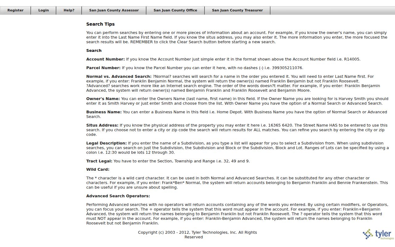
Use the screen as a field guide, then retain the account and parcel numbers shown by the returned public record. A broad street-name result still needs an address, parcel, or legal-description check before it supports a records request.
Farmington Records Along a Street
Several agencies hold address-keyed records, but each answers a narrow question. The Farmington street directory path is strongest when it separates assessment data, parcel context, recorded documents, and local government files. The table distinguishes the recordkeeper from the conclusion a record can support.
| Address-keyed source | Custodian | What it can show | Access boundary |
|---|---|---|---|
| EagleWeb assessment account | San Juan County Assessor | Situs, account, parcel, legal summary, tax area, and assessment labels. | Public guest route; not title proof or a current-resident list. |
| Parcel Map | San Juan County | Administrative parcel geography reached from an EagleWeb account. | Map controls were not fully verified; it is not a survey or title decision. |
| Recording index and copies | San Juan County Clerk | Grantor/grantee discovery and recorded-document copies when identifiers are supplied. | No verified online coverage-start date; staff do not perform detailed real-estate searches. |
| City permit reports and files | Farmington Building Inspection and City Clerk | Monthly permit-report leads and address-specific municipal records. | Reports begin in 2021; permits are not issued online and files need the appropriate request or office check. |
| County permit records | San Juan County Community Development | County applications, inspections, and parcel-search context. | Use for unincorporated county matters, not as a substitute for Farmington city records. |
The San Juan County Clerk Recording Department asks for a book/page or document number when requesting copies. That makes the EagleWeb account and legal summary useful preparation. The county describes its online recording access as grantor/grantee searching and did not publish a verified coverage-start date in the source reviewed here.
Farmington Street Directory Map Context
After identifying an account, use its Parcel Map link for administrative geography and compare it with the City of Farmington Maps & GIS resources when the address may be inside city limits. The city expressly says its maps are not legal surveys or proof of title or boundary. County mapping is likewise useful context, not a replacement for a recorded plat, survey, or professional review.
A parcel can reveal why the next record should go to the city, the county, or the clerk. It cannot settle a line on the ground. For a Farmington street question that depends on an exact boundary, retain the map date and scale, then seek the recorded plat or survey through the County Clerk.
Map context also helps keep similar-looking labels apart. An EagleWeb tax area is an assessment field. A City/Zip entry narrows a situs search. A municipal map can show city-maintained context. None of those labels replaces the parcel's legal description. When the question is about a roadway, request the defined city or county record that names the project, date range, and affected address or block instead of treating a map label as the underlying record.
Note: City and county maps can provide useful context, but the legal description and recorded survey remain the stronger sources for a boundary conclusion.
Farmington Streets in the 1908 View
Farmington's historic street pattern is not a perfect grid. The City's 2019 historic-resources plan describes the 1879 Pierce plat around East Main Street and notes that some cross streets still jog around early family-property patterns. That documented quirk is a reason to compare block, lot, landmark, and date instead of assuming the next visible street number identifies the next legal parcel.
The Library of Congress Farmington Sanborn map is a November 1908, one-sheet snapshot. It can help compare historic street labels, block relationships, building footprints, and uses within its covered area. It cannot supply a current parcel boundary or a citywide historical address database.
Farmington Street Names Through Time
No official Farmington citywide street-name-change index or renumbering table was verified in the research. That gap matters. A current street label and an older reference should not be treated as the same place without support from a dated map, ordinance, recorded plat, directory, or agency record.
For a specific historical question, give the City Clerk or the relevant county office both the current and suspected older street terms, the block or parcel when available, and a date range. The Farmington Public Library, the San Juan County Historical Society, historic newspapers, and the 1908 map can offer date-aware leads. They remain leads until a cited source establishes the match.
Farmington Street Directory and Deed Records
Recorded instruments become easier to request after the property account provides a parcel number and legal context. The County Clerk's official route supports grantor/grantee searching. A grantor is the party transferring an interest; a grantee is the party receiving one. Those names describe a recorded instrument, not a finding that either party presently occupies the property.
The Clerk requires a full legal description for recording and says a street address alone is not accepted for that purpose. It also accepts copy requests at clerks@sjcounty.net when the request includes a book/page or document number. The published schedule lists copies at $1 per page and certification at $1, subject to confirmation before payment. The online index's coverage beginning, result fields, and image availability were not verified in the research, so do not fill those gaps with assumptions.
This is why a Farmington street directory search should retain a clean chain of labels: address components, EagleWeb account, parcel number, legal summary, index identifier, and the date of each source. When a question shifts from a current street record to past directory volumes, the Farmington city directory material is the better historical shelf.
Farmington Street Directory Terms
The same address can appear under several labels. Reading each label literally prevents an assessment screen, map, or document index from being turned into a claim it does not make.
- Parcel
- A county land-account identifier used to connect assessment information with the Parcel Map. It is not a statement about a household.
- Situs address
- The property location recorded on an assessment account. It is different from an owner mailing address and may have its own formatting.
- Plat
- A recorded map of a subdivision or land division. A plat can clarify lot and block context but should be read with its recording details.
- Legal description
- The land description used in recorded documents, such as subdivision, lot, block, tract, section, township, and range information.
- Criss-cross directory
- A directory arranged by address rather than by name. No Farmington run or holdings list was verified, so ask the library or historical society about a precise year.
Limits of a Farmington Street Directory
A street search can establish administrative and recorded-document context. It cannot provide an authoritative public roster of current occupants. EagleWeb's owner and mailing fields are assessment labels; the recording index is grantor/grantee based; and the voter portals are self-service or restricted data routes, not public street browsers. Court access also omits addresses and other protected information. Missing information should remain a limitation, not become a reason to combine unrelated records.
New Mexico Safe at Home protects the actual addresses of qualifying participants through a substitute-address program. Never attempt to infer, compare, or reconstruct a protected address from property, map, court, or election material. For a specific city file not posted online, a narrowly framed IPRA request should identify the address, record category, date range, and department likely to hold it.
Lawful use. Use Farmington street and parcel records for lawful personal research, property context, family history, or a defined public-record request. Do not use a record lead to stalk, harass, intimidate, or harm anyone.
Note: A source label and access date make an address finding more reliable than an unsupported conclusion assembled from several unrelated screens.