
Farmington Neighbors as Parcel Context
For this purpose, a neighbor means a nearby parcel whose relationship is identified on a stated county map or recorded land source. It does not mean a current resident, a contact, a shared household, or a personal relationship. Start with the subject parcel, then describe the relationship precisely: adjacent parcel shown on the county map, across-street parcel, same block or subdivision, or recorded plat reference. That language is more accurate around irregular frontage, units, highways, alleys, municipal sites, and lots that do not line up with street numbers.
| Source | What it shows about a block | Access |
|---|---|---|
| San Juan County EagleWeb | Assessment account, parcel number, situs and legal context | Public guest route |
| County Parcel Viewer | County parcel geography reached from an EagleWeb Parcel Map link | Public map; controls need a live-session check |
| County Clerk | Recorded plat, survey, and instrument copy route | Index route and identified-copy request |
| City or county record custodian | Defined permit, roadway, map-layer, or public-infrastructure record | Request to the responsible office |
| NMVote and voter-data routes | Personal voter service or controlled election data, not a block roster | Self-service or restricted request |
The table separates what the sources can support. A parcel map gives geometry. An assessment card gives administrative property labels. A recorded plat or survey can be the better source when a boundary question matters. None of them identifies who is currently at a site.
Farmington Parcel Map Records
The verified starting point is the public San Juan County EagleWeb account. Its structured situs search can narrow an address using components such as house number, street name, designation, direction, unit number, and City/Zip. Save the returned account number, parcel number, legal summary, and source date. EagleWeb exposes a Parcel Map link from an account card and passes county parcel context to the County ArcGIS viewer. Preserve the parcel number before leaving the property card because it is the verified handoff between the account and map routes.
The public research did not capture the Parcel Viewer’s live selection, buffer, adjacent-parcel, ownership-label, layer, export, or print controls. Read the live map legend and popup in a normal session rather than assuming any exact map tool exists. The Assessor also cautions that taxable value is an assessment figure, not market value. An assessment owner or mailing field remains an administrative label, not a statement about occupancy.
Note: Keep EagleWeb’s situs, owner, owner mailing address, legal summary, tax area, and parcel number as separate labels.
Map Farmington Neighbors by Geometry
Use a documented process flow instead of a casual next-door assumption. The goal is to identify parcel relationships around the subject address, then retrieve a nearby assessment card only by its lawfully observed parcel number. This is especially important at corners, curved streets, multi-parcel sites, and places where a street line does not match the parcel line.
- Enter the subject address in EagleWeb’s structured situs fields and verify the returned account context.
- Record the account number and parcel number, then open the account’s Parcel Map link.
- On the live map, state the visible relationship as shared-boundary, across-street, same block, or nearby map context. Retain the map scale and date.
- When a nearby parcel number is shown, return to EagleWeb for that assessment card and preserve its labels without treating them as occupancy facts.
- For a boundary or subdivision question, follow the legal description to the County Clerk’s recorded plat or survey copy route.
Parcel geometry is the evidence. It can explain where Farmington neighbors are in relation to an address without claiming who lives there. For a full named-street record sequence, the Farmington street directory follows the wider address-by-address workflow.
Farmington Block Plat Records
A legal description is often stronger than a street-number sequence for a Farmington block. EagleWeb supports Subdivision, Lot, Block, Tract, and Unit fields, while the County Clerk provides the route to recorded plats, surveys, and documents. The Clerk says plats and divisions effective August 1, 2011 require Subdivision Review approval. Those records can clarify how lots sit within a subdivision, but a subdivision name does not prove a neighborhood association, shared governance, or a resident relationship. No official Farmington neighborhood-association directory was found in the research, so informal map labels should not be presented as one.
- Parcel
- A mapped unit of land used in county assessment and mapping records.
- Plat
- A recorded map that lays out lots, blocks, streets, or other land divisions.
- Legal description
- The formal land description used in recorded documents, distinct from a mailing or street address.
- Same block
- A map relationship that should be identified by the displayed block, parcel lines, and source date, not by a guess from street numbers.
The Clerk accepts copy requests with a book/page or document number and asks for a full legal description for recording. Staff do not perform detailed real-estate searches. That is why the assessment-account and parcel sequence should come before a broad block request.
Farmington Grid Map Records
Farmington’s documented downtown form is a local reason to avoid simplistic block assumptions. The City’s 2019 historic-resources plan describes the 1879 Pierce plat, centered on East Main Street, and notes that some cross streets jog around early family-property patterns. A map comparison may therefore need a lot, block, subdivision, landmark, or date check before calling two parcels adjacent. The plan does not establish a citywide street renumbering or a present property line.
The Library of Congress Farmington Sanborn map from November 1908 is a one-sheet historical view that can help with a dated street or block question inside its coverage. It is not a current map, survey, or citywide archive. Pair its street labels and footprints with a current county parcel source and, when needed, a recorded plat or survey.
Farmington Block Record Requests
When a public map does not answer a defined government-record question, request the record class from the proper custodian. For an address inside city limits, the Farmington IPRA route directs requests through the City Clerk and its NextRequest system. For unincorporated San Juan County, Community Development, Rural Addressing, or the county permit route may be the better custodian. Include the parcel or account number, block or subdivision when known, record type, department, and date range. Do not ask for “all neighbor information.”
The San Juan County SmartGov public portal is the verified county permitting route. It displays Parcel Search and routes for viewing applications and inspection results. Its scope is county permitting and community development, separate from Farmington’s city construction-permit process.
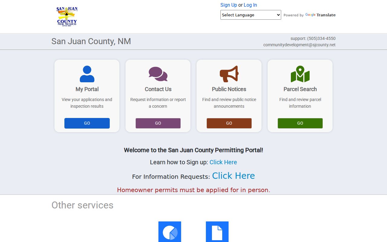
A permit or inspection lead remains a separate, address-specific record request. It does not identify a household or establish a resident connection.
Farmington Neighbor Tools Compared
Official parcel sources and commercial neighbor-search categories serve different purposes. The official route ties a fact to a named public custodian and record label. A commercial category may combine old or mismatched data, but it does not replace the parcel, plat, or agency record. For a Farmington block question, use the source that fits the claim and retain the access date.
| Official parcel records | Commercial neighbor-search category |
|---|---|
| Shows assessment or map context under county labels | May group information from mixed sources with unclear update timing |
| Can connect an account to a parcel number and legal context | Cannot replace a recorded plat, survey, or official instrument copy |
| Supports a stated parcel relationship with a source date | May not distinguish ownership, mailing, occupancy, or an old address |
Neither category turns nearby geometry into a personal relationship. For a significant boundary or title question, the appropriate escalation is the recorded plat or survey and professional review.
Farmington Neighbors and Voter Limits
NMVote and the SERVIS Voter Portal are self-service tools, not public street-by-street voter browsers. New Mexico voter-data release follows a separate regulated route. San Juan County’s request form is organized around electoral geography and stated request choices, not a house-number search. County rules limit use to government representatives, candidates, and campaign representatives, require a signed affidavit, and prohibit unapproved use. Voter material cannot be used to determine who is connected to a particular block.
New Mexico Safe at Home protects actual-address information for qualifying survivors through a substitute-address program. Protected location information is not a gap to work around with maps, assessment labels, court material, or surrounding parcels.
Note: A public map relationship and an election record serve different legal purposes and should not be combined into a block roster.
Farmington Neighbor Privacy Limits
Assessment cards and maps are administrative sources. They do not establish current occupants, household members, deliveries, utilities, voting behavior, social ties, or a right to assemble personal data. The City maps page warns that municipal maps are not legal surveys or proof of title or boundary. A map label also cannot resolve title. Use the County Clerk copy route for a recorded plat or survey, and preserve the source, identifier, date, and exact field name when describing a record.
Lawful use. Use Farmington parcel and public-record sources for a specific, lawful property or civic question. Do not use map or record leads to stalk, harass, threaten, or expose protected information about anyone.